February 2018 By: Jane Hammond
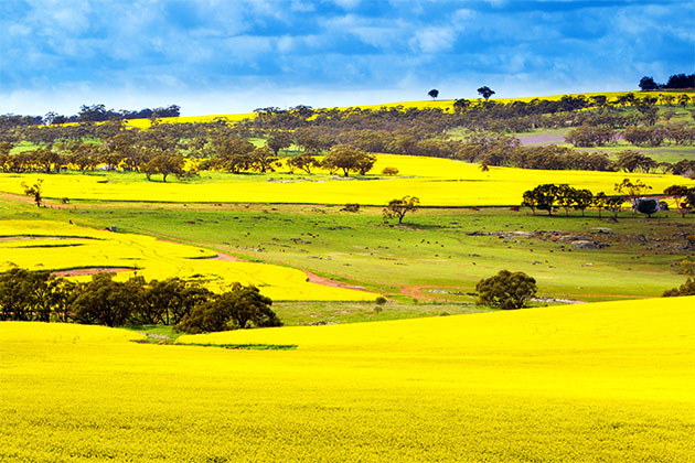
Behind the gums and golden fields of grain of the central eastern Wheatbelt are the small farming communities that provided many young men for the state’s heroic 10th Light Horse Regiment in the First World War and played a pivotal role in preparing for the nation’s defence in the Second World War.
Tracing the military history of the Wheatbelt through both world wars is a fascinating way to explore this region and offers opportunities to discover the human stories of loss and valour and the mystery of once top secret war-era installations.
I was inspired to make this trip by the region’s plans for Anzac commemorations to mark the 100th anniversary of the Gallipoli landing and by the Wheatbelt’s enthusiastic participation in the Remembering Them project, which tells the stories of the impact of WWI and II on rural communities.
From Perth, follow the Great Eastern Highway to Spencers Brook Road, just east of the tiny locality of Clackline.
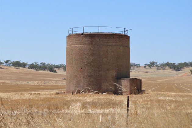
After the turn-off it was only 20kms along the road until we spotted our first piece of military history: a series of round silo-like structures standing like sentinels in a paddock, near Burlong Pool.
The structures were once aviation storage tanks and were among 31 fuel depots dotted across Australia storing more than 93 million litres of aviation fuel in WWII.
Standing around 15m high, they make for a dramatic fixture in the landscape.
The Old Railway Museum in Northam offers an in-depth look at the region’s military history.
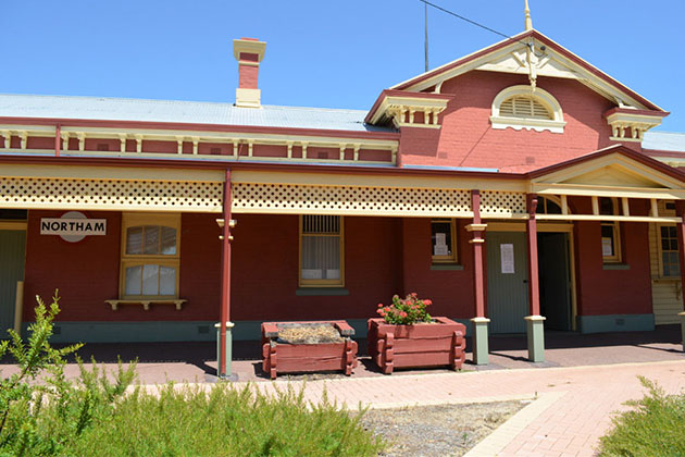
The museum is home to a collection of military artefacts and details the history of the Northam Army Camp and its later use as an accommodation centre for thousands of post-war WWII refugees.
Among the artifacts is a rare portrait of local farmer Hugo Throssell, the only 10th Light Horseman to receive a Victoria Cross in the Great War. He received the honour for his gallant efforts at Gallipoli.
War camps and museums
You can see the Northam Army Camp, although you can’t go inside, just before you reach the town centre. Poster boards by the road describe the camp’s history.
Northam’s pedestrian suspension bridge over the Avon, the largest span of its type in Australia, is also worth a visit.
From Northam continue along Great Eastern Highway to Meckering, where it is worth a quick stop to see the display boards and buckled railway lines from the town’s 1968 earthquake.
Next stop is the pretty town of Cunderdin.
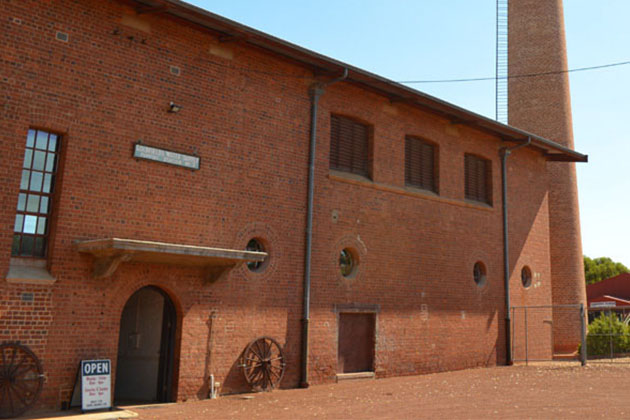
The magnificently restored No 3 Pump Station, just off the highway, is home to a museum featuring military history as well as the story of the Kalgoorlie Goldfields Pipeline and the agricultural heritage of the area.
Inside the museum is an earthquake simulator, which provides a thrilling few minutes.
The Cunderdin Airfield can be found by turning off the highway at an appropriately placed Tiger Moth. Follow the road out of town to find the WWII pilot training school, complete with many old buildings including huts and hangars.
The airfield is used by the Gliding Club of WA but was once an important training facility for pilots before they left for further training in England.
Towards the end of WWII it was used by heavy bombers in the campaign against the Japanese occupied Netherlands East Indies.
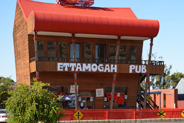
Cunderdin is also the home of the Ettamogah Pub, a faithful recreation of the cartoon pub from the now defunct Australasian Post magazine.
After Cunderdin, head to Merredin, where there are many options for an overnight stay, from caravan parks to hotels and bed and breakfasts.
Merredin is proud of its military history and has a wide range of landmarks and ruins to discover and explore.
These include the footings of the Australian General Army Hospital near Merredin Peak; the Aviation fuel tanks behind the BP Roadhouse on GE Highway; the RAAF No 10 Stores Depot on the Nungarin Merredin Road; and the RAAF Airmen’s Mess at 68 Bates Street.
The Merredin Military Museum, on the Great Eastern Highway, just next to the water tower, has a wide range of military armory, tanks and vehicles including a rare communications truck and even a Vietnam War Iroquois helicopter.
Museum manager and local historian Rob Endersbee says many of the area’s wartime structures survived simply because they were too difficult to knock down.
Among the most intriguing war relics is a huge train-shaped concrete structure, thought to be a WWII radar installation.
Located on private property on the Merredin-Chandler Road just past the shire depot, Mr Endersbee says the structure’s use was so secretive that its exact title and purpose remains a mystery.
North of Merredin on the Nokanning East Road is the RAAF No 6 Central Reserve Munitions Depot. Forty-six concrete igloos of varying designs and sizes were spaced erratically in the fields to appear insignificant from the air.
They housed artillery and munitions in WWII and were guarded by around 40 soldiers housed in wooden huts hidden in the trees.
In Nungarin, north of Merredin, is the amazing Nungarin Heritage Machinery and Army Museum. The collection is housed in a massive wooden shed, once the home of an army vehicle workshop that serviced and stored more than 4000 vehicles during WWII.
North of the town you can also see massive firewalls left over from the war years. They stand alone as single walls set at different angles and were designed to stop fire from destroying multiple buildings in the event of an attack.
Continue to follow the Pioneers’ Pathway Trail as it winds through the Wheatbelt towns of Trayning, Wyalkatchem, Dowerin, Goomalling and Toodyay.
In Goomalling make sure you see the Dolly Twins – towering domelike structures built in 1994 that are used to store wheat.
Take a short detour 15kms from Goomalling to Jennacubbine and here you’ll find the refurbished Jennacubbine War Memorial, erected as a tribute to the locals from the district who enlisted in WWI.
Your final stop is the picturesque town of Toodyay. Admire its beautiful stone buildings as you break for Devonshire tea at one of the town’s cafés, then follow Toodyay Road until you meet Roe Highway as you head back to Perth.
Your drive will have covered more than 600kms of roads and you will have witnessed an important part of the state’s military past.
You will also have met some of the extraordinary characters, all of whom are working hard to preserve our state’s fascinating war history.