27 June, 2018 By: Vanessa Pogorelic
We talk about it, read about it and some of us even have strange ways of predicting it.
Our climate and its many extremes, has a big impact on our lives, particularly in a state the size of Western Australia.
Here are just some of the facts and quirks about our weather you may not have known.
Where do we get the most lightning in WA?
If you’re into lightning then go to the North East Kimberley during the wet season.
Although we get lightning anywhere in the State and at any time of year, the North East Kimberley is the lightning capital of WA. During the wet season from November to April you can see huge amounts of lightning and thunderstorms.
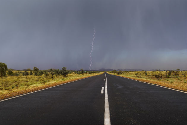
The reason is that during the wet season, the Kimberley has on a daily basis two of the ingredients needed for lightning strikes - abundant moisture and instability, or an atmosphere that allows clouds to develop to great heights. To get great lightning, all you then need to add then is the third ingredient, a trigger, which could be as simple as a sea breeze forming clouds through to a low pressure trough.
If you ever find yourself close to a lightning storm, remember to take shelter - but not under a tree.
If the tree gets hit, the lightning could strike you, and the sap could be vaporised and explode outwards. If you’re in a car don’t touch the body of the car or anything metal inside it. If you’re out in the open with no other shelter try and make yourself as small as possible by crouching down into a ball and putting your hands over your head.
The good news is that it is widely reported that nearly 90 per cent of people hit by lightning survive.
Why is it quicker to fly from Perth to the east coast than it is to fly back?
It’s because of the subtropical jet stream.
A jet stream is an area of very fast-moving winds in the middle part of the atmosphere. We have two jet streams that effect WA - the polar front jet stream and the subtropical jet stream.
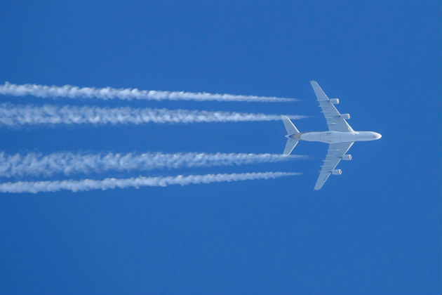
The polar front jet stream occurs in the boundary between the cold air from the south and warmer air from the north. The subtropical jet stream blows from west to east so aircraft will try to find it and use it when flying from Perth to Sydney or Melbourne.
The polar front jet stream is more evident in WA during the winter months in the South West while the subtropical jet stream is present for the whole year.
Where are Perth’s daily temperature readings taken?
They are taken at Mt Lawley weather station.
So when you hear what the temperature was today, it was actually the temperature in Mt Lawley. Temperatures across metropolitan Perth can vary by as much as 10-15 degrees from one side of the city to the other - especially during summer when the coast will be cooler than the hills.
How strong can the wind blow in WA?
The wind in WA is world beating. In fact, the world’s strongest recorded wind gust was at WA’s Barrow Island – it was 408km/h and occurred during tropical cyclone Olivia on 10 April 1996.
The strongest gust ever recorded on mainland Australia was also in WA. It blew at 267km/h and was recorded at a weather station at Learmonth, south of Exmouth, during tropical cyclone Vance on 22 March 1999.
Are there people based at weather stations around WA?
Not many. The Bureau of Meteorology has just over 90 weather stations around WA and most are automated with no-one onsite.
However Albany, Broome, Cocos Island, Esperance, Geraldton and Perth Airport are manned and partially automated.
Weather stations are situated carefully to avoid interference from structures in the built environment, such as roads, pavement and buildings that could interfere with the information being recorded, including heat retained by road surfaces affecting temperature readings.
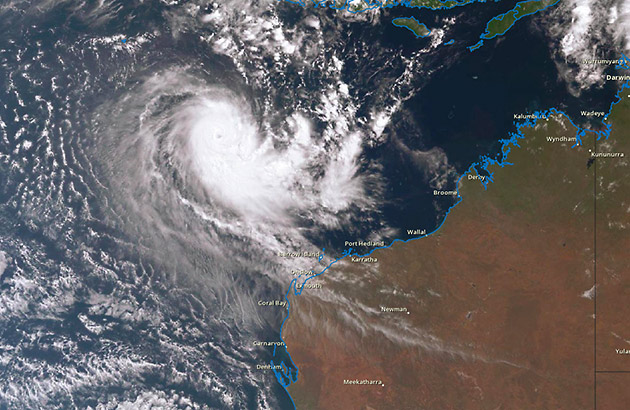
WA’s north is the most cyclone-prone region in Australia
The coastline between Broome and Exmouth is Australia’s most cyclone-prone region.
During cyclone season, from November to April, an average of five tropical cyclones develop in the region, with around two crossing the coast. There’s a higher chance of experiencing a severe tropical cyclone later in the season.
Why and how are cyclones named?
Cyclones are given names so they can be easily identified for emergency services, shipping and public announcements.
Until the 1970s cyclones were only given female names. During the ’70s, the Australian Government decided male names would also be used.
Today the Bureau of Meteorology has three alphabetical lists of first names that it uses to assign cyclone names, alternating between male and female names.
From time to time new names are added and include those that reflect the multicultural nature of the Australian community.
Because cyclones are life threatening and people who live through them can be left with traumatic memories of the event, when there is significant damage and a cyclone is a category three or above, that name is retired from the list.
For example, the highly destructive Cyclone George that hit Port Hedland in 2007 also resulted in three deaths. Therefore, the name George has been retired from the list of potential cyclone names.
Protect your home from wild weather
You can't always predict bad weather, but you can cover your house and belongings from damage. RAC Home and Contents Insurance will cover your home (and belongings) against weather events such as fire, flood, and storm.
Issued by RAC Insurance Pty Limited. Check the PDS & TMD at rac.com.au.